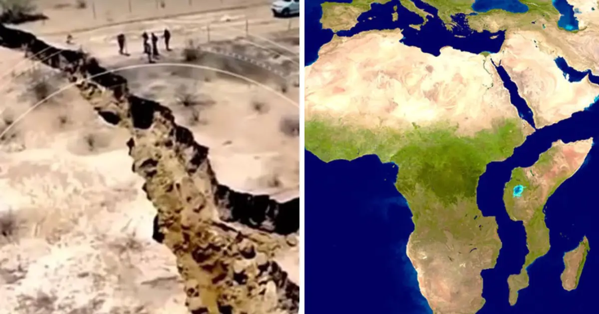
In East Africa’s Afar region, one of the world’s hottest locations, it is feasible to stand on the precise location where the continent is separating deep underground. This barren area is located above the intersection of three tectonic plates that are gradually pulling apart, a complicated geological phenomenon that will, according to scientists, ultimately divide Africa in two and generate a new ocean basin millions of years from now. The most visible proof of this process is a 35-mile fissure in the Ethiopian desert.
Geologists have discovered that the two segments of land that form the world’s second-largest and second-most inhabited continent are beginning to divide, paving the way for a completely new ocean to emerge from the rift.

University of Rochester
Should the land continue to separate, nations like Zambia and Uganda may eventually acquire their own shorelines. In accordance with the peer-reviewed publication, Geophysical Research Letters, researchers have verified that the African continent is being bisected, resulting in the formation of a new ocean.
“This is the only place on Earth where you can study how continental rift becomes an oceanic rift,” said Christopher Moore, a Ph.D. doctoral student at the University of Leeds, UK.
Scientists have managed to pinpoint the exact location where the continent, covering an area of over 30 million square kilometers, originally ruptured deep beneath the surface. This crevice is located at the intersection of three tectonic plates that have been gradually drifting apart over an extended period.

Nerthuz / Alamy Stock Photo
Geologists have observed that this intricate tectonic activity will ultimately create a brand-new water body in the distant future. In 2005, the East African Rift, a 35-mile-long fissure in the Ethiopian desert, first emerged, according to the findings of the collaborative effort.
The creation of Africa’s new ocean is projected to take anywhere from 5 to 10 million years, but the Afar region’s favorable location at the juncture of the Nubian, Somali, and Arabian plates provides a unique opportunity to investigate intricate tectonic processes.
The Earth’s crust is composed of about a dozen large tectonic plates, irregularly shaped, rocky slabs that continually collide, climb, slide, or stretch away from one another.

Peter Hermes Furian / Alamy Stock Photo
Over the last 30 million years, the Arabian plate has moved away from Africa, resulting in the formation of the Red Sea and the Gulf of Aden between the two connected land masses. However, the Somali plate in eastern Africa is also separating from the Nubian plate, peeling apart along the East African Rift Valley that extends through Ethiopia and Kenya. Nevertheless, there are still many unknowns, including what is causing the continent to split apart. Some experts believe that an enormous plume of superheated rocks emerging from the mantle beneath East Africa could be driving the continental rift in the region. In recent years, GPS equipment has revolutionized this field of study, enabling scientists to precisely measure how the ground shifts over time.

University of Rochester
“With GPS measurements, you can measure rates of movement down to a few millimeters per year,” said Ken Macdonald, a marine geophysicist and professor emeritus at the University of California, Santa Barbara.. “As we get more and more measurements from GPS, we can get a much greater sense of what’s going on.The Gulf of Aden and the Red Sea will flood in over the Afar region and into the East African Rift Valley and become a new ocean, and that part of East Africa will become its own separate small continent.”
The three tectonic plates are separating from each other at varying speeds, with the Arabian plate moving away from Africa at a rate of approximately one inch per year, according to the geophysicist. The African and Somali plates are said to be separating at an even slower rate, around half an inch to 0.2 inches per year.
(h.t: nbcnews)

